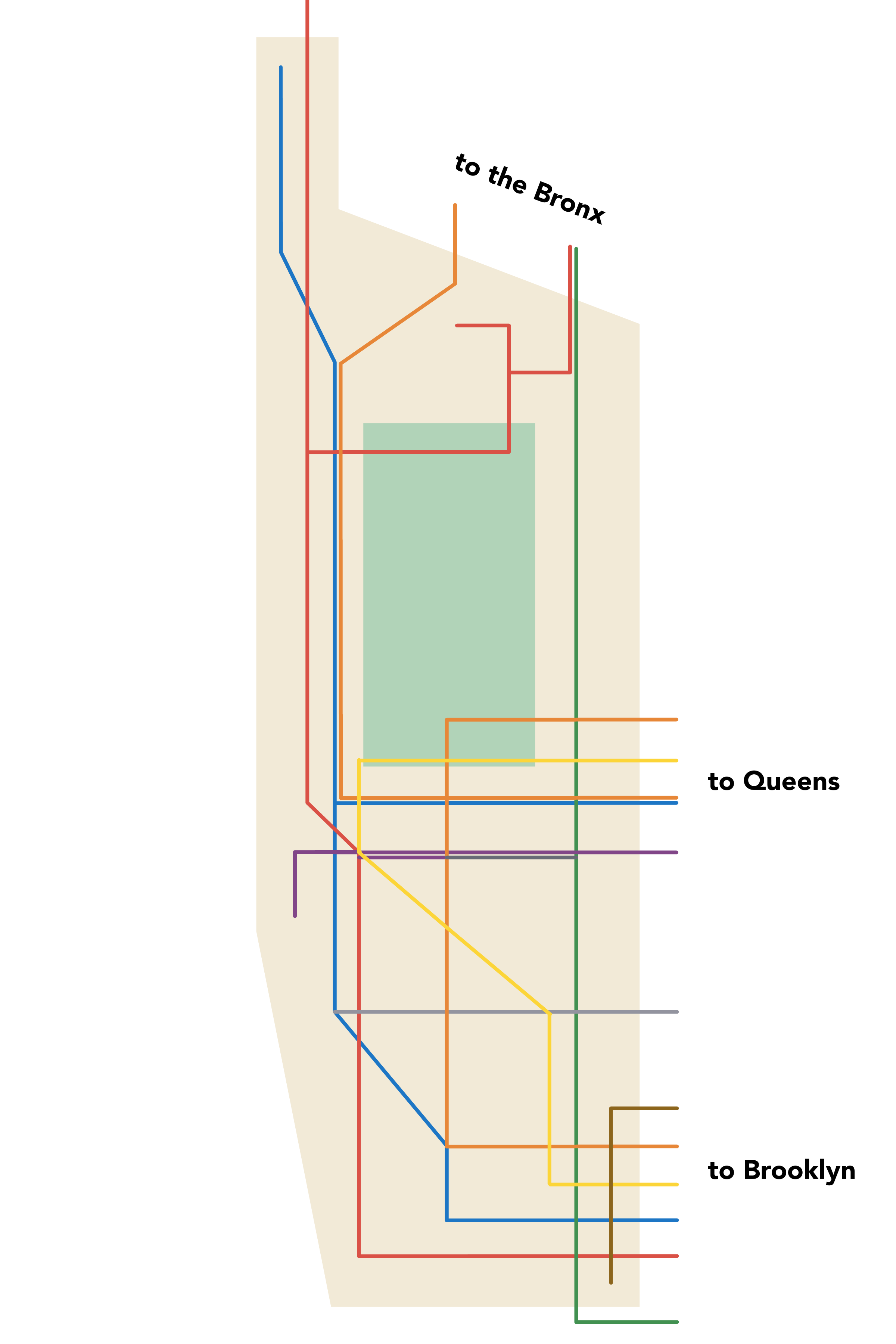
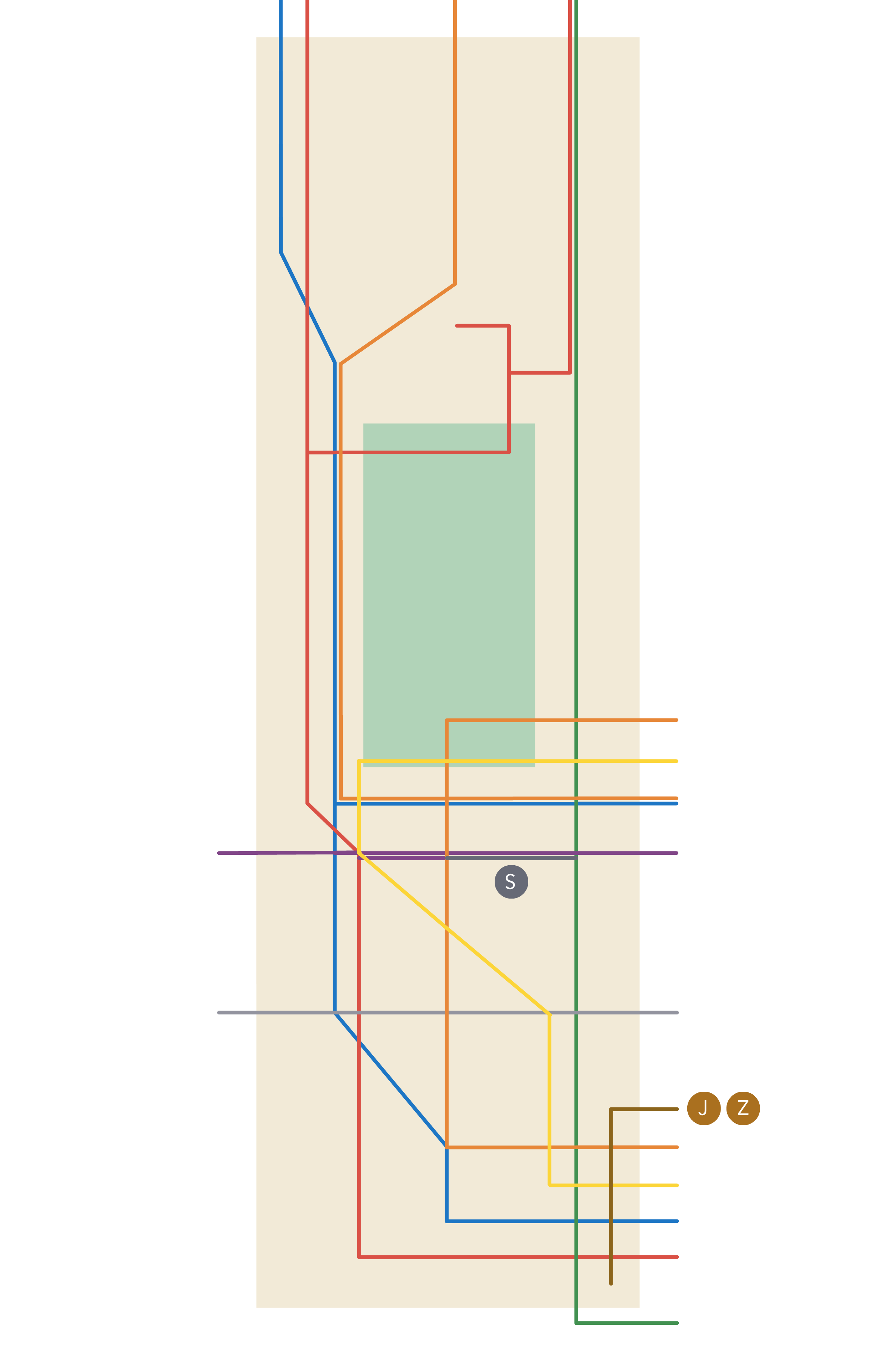
The Manhattan subway map looks like a confusing mess, but it’s actually pretty simple. Even the most fresh-faced transplant can make sense of it, if you just break it down into what you really need to know:
|
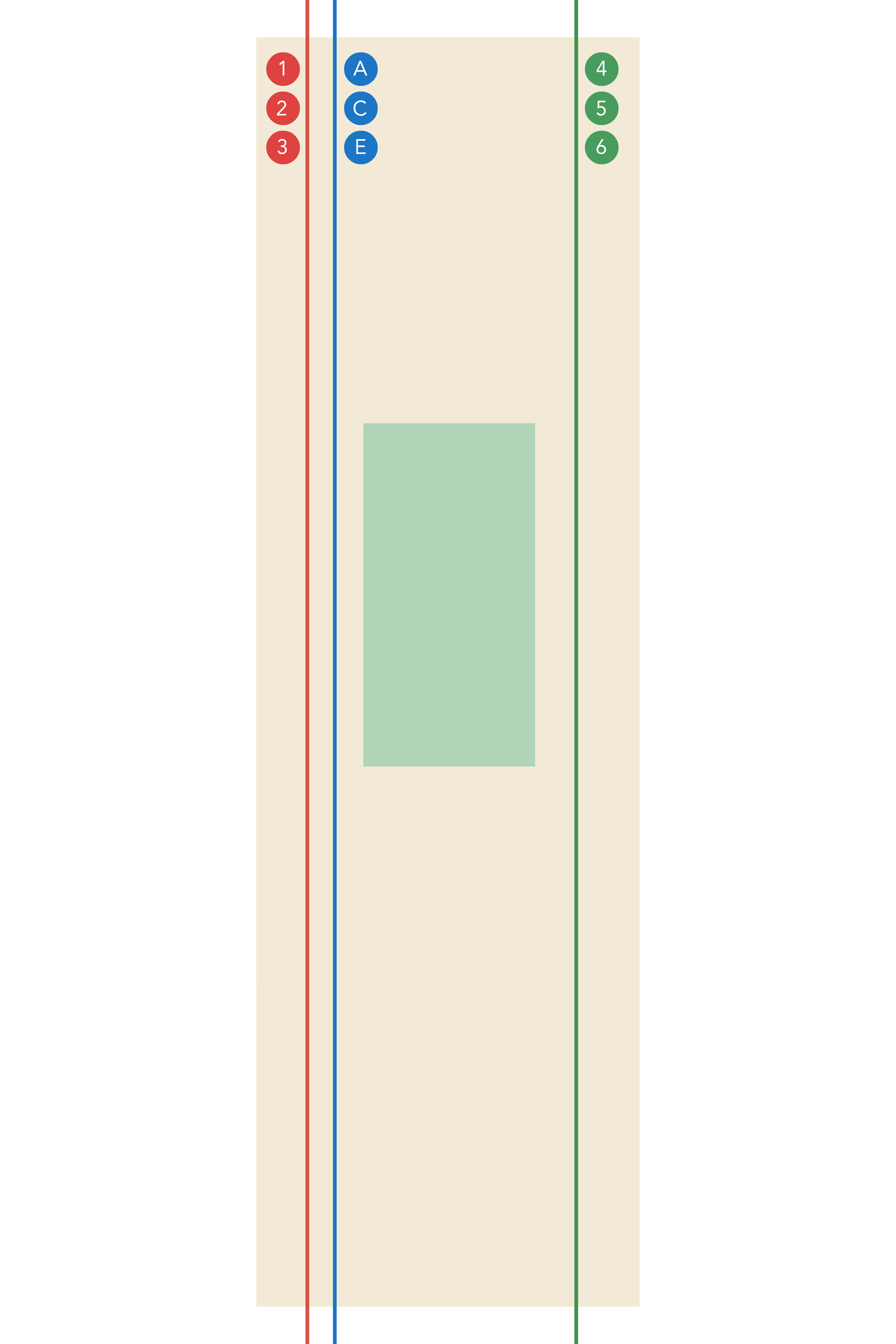
1. Manhattan is pretty much a rectangle. |

|
|---|
|
2. Most trains run up and down the island. |
|---|---|
|
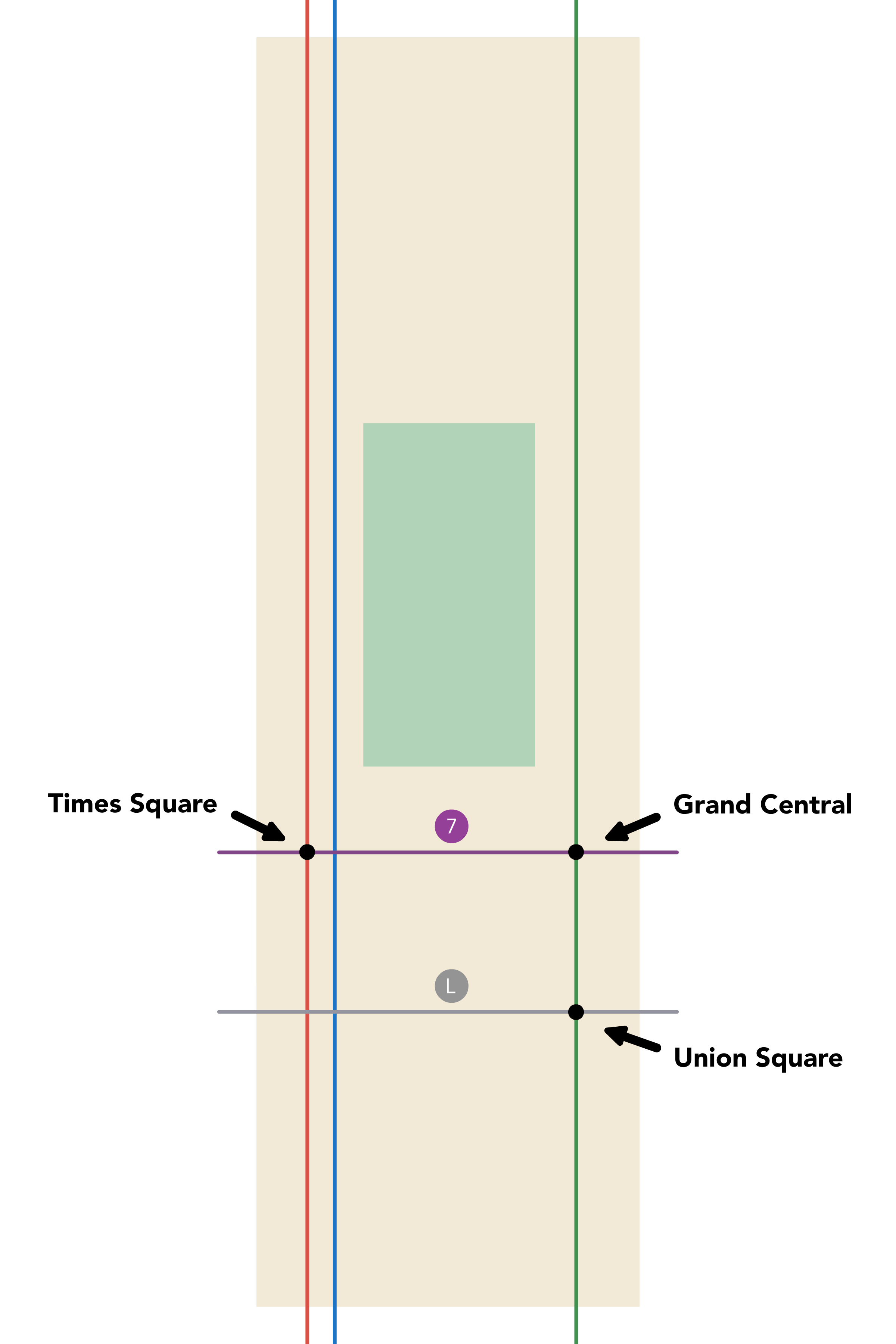
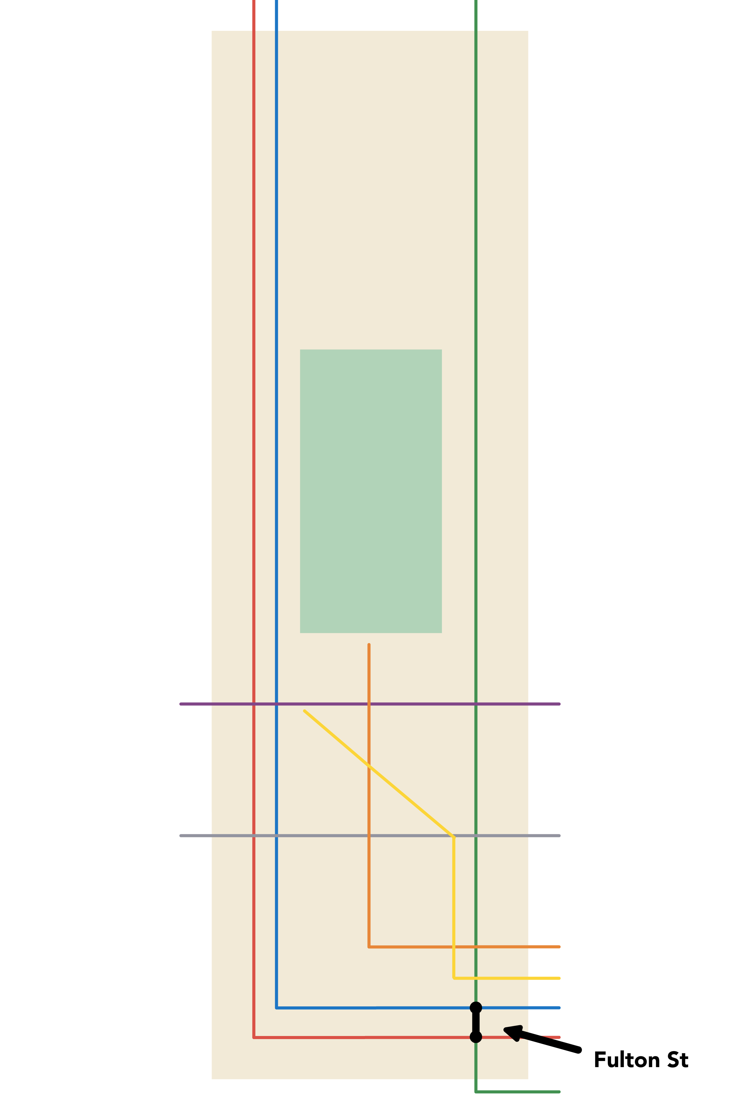
3. You can go crosstown at 14th and 42nd, |
|
|
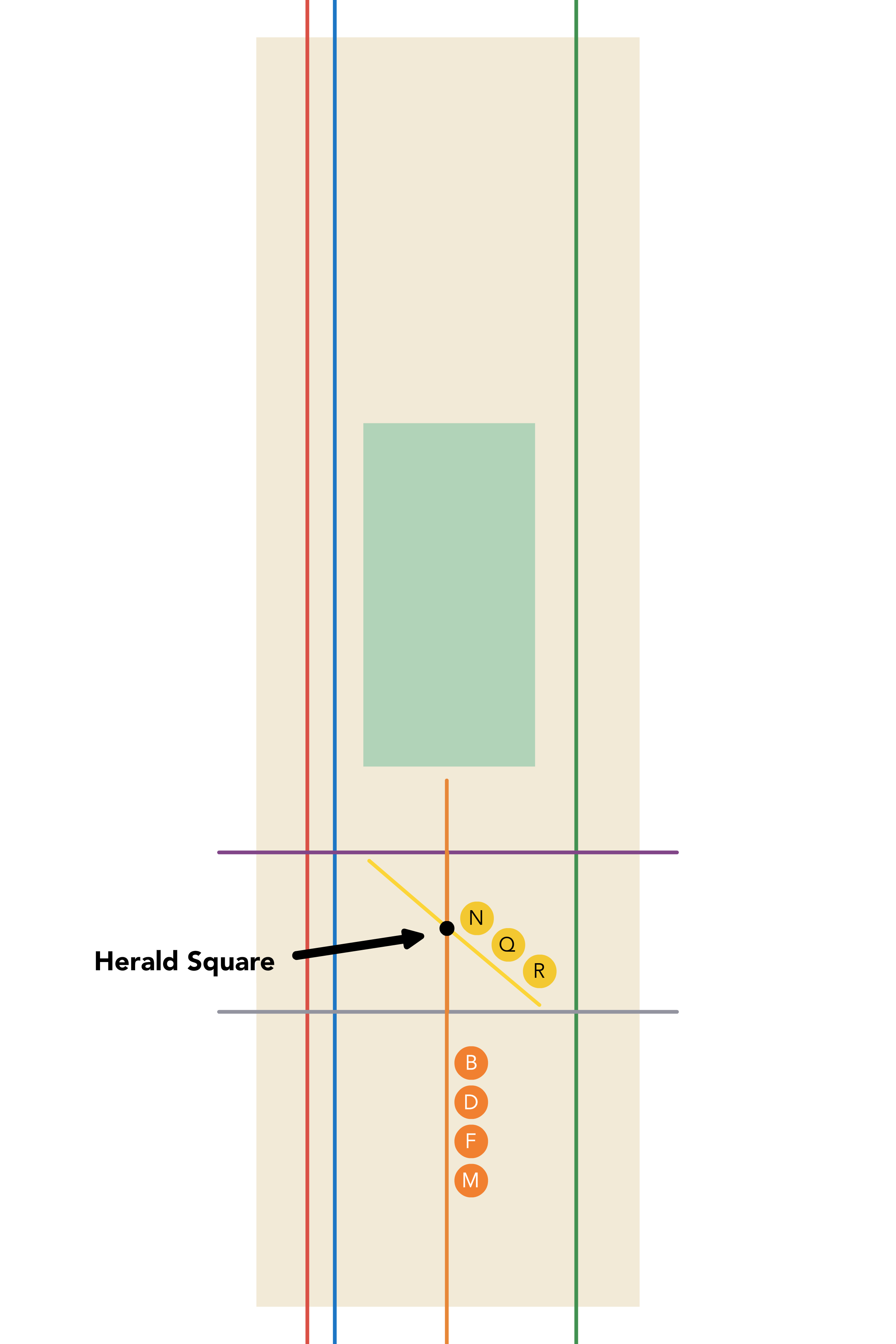
4. Below Central Park, the orange and |
If you have this map in your head, you’ll do a pretty good job of navigating Manhattan. If you need to leave Manhattan, that’s easy too:
|
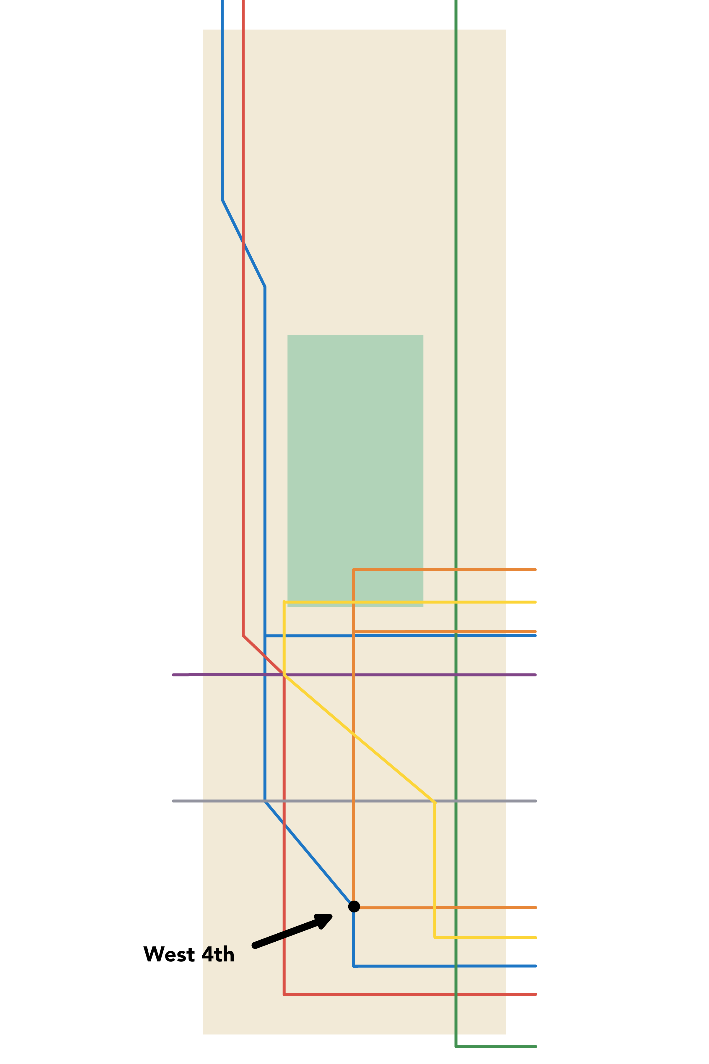
5. Below 14th, all the lines head east into Brooklyn. |
|
|---|---|
|
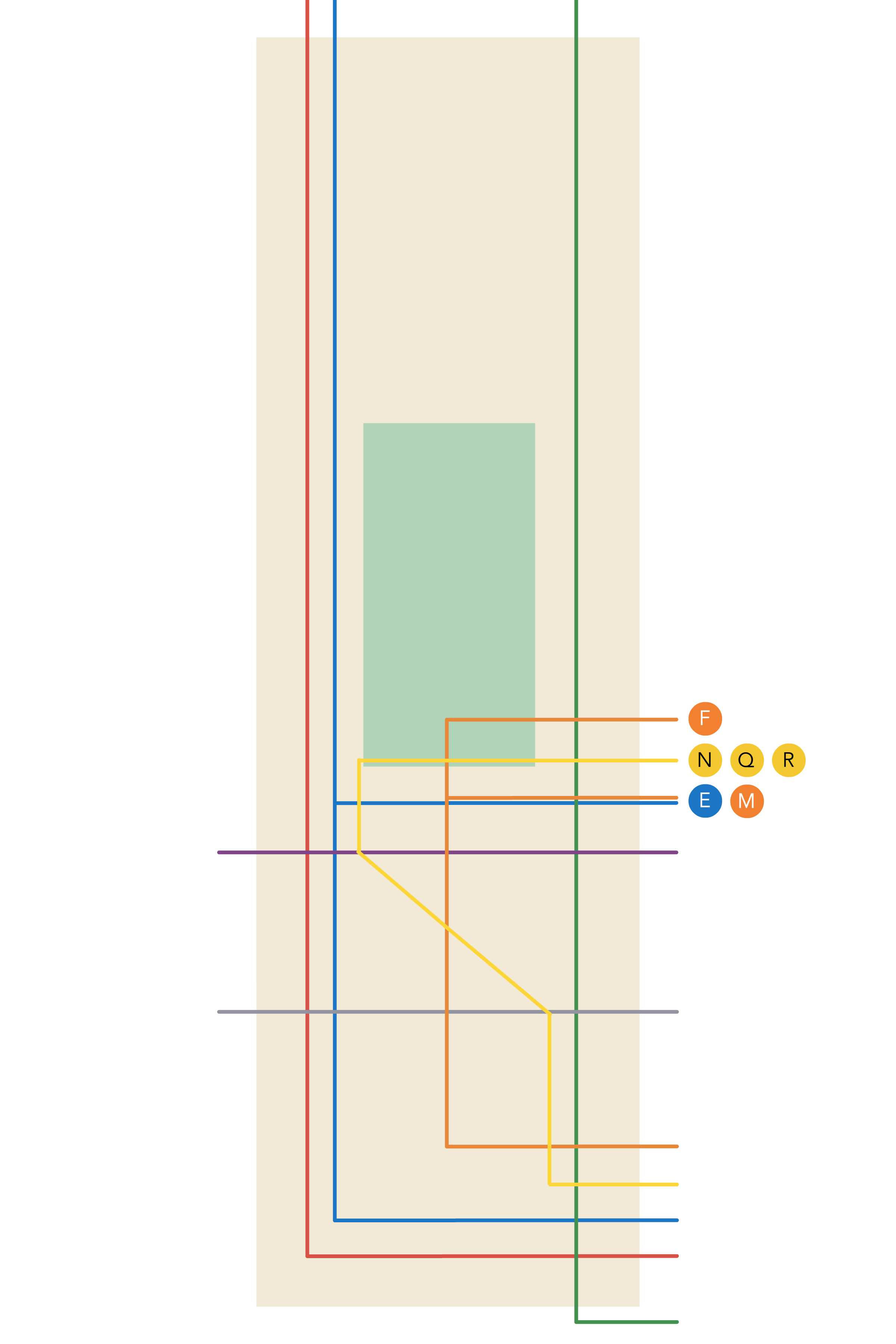
6. Starting around 53rd, a handful of trains |
That’s pretty much the gist of it. There are three more key complications:
|
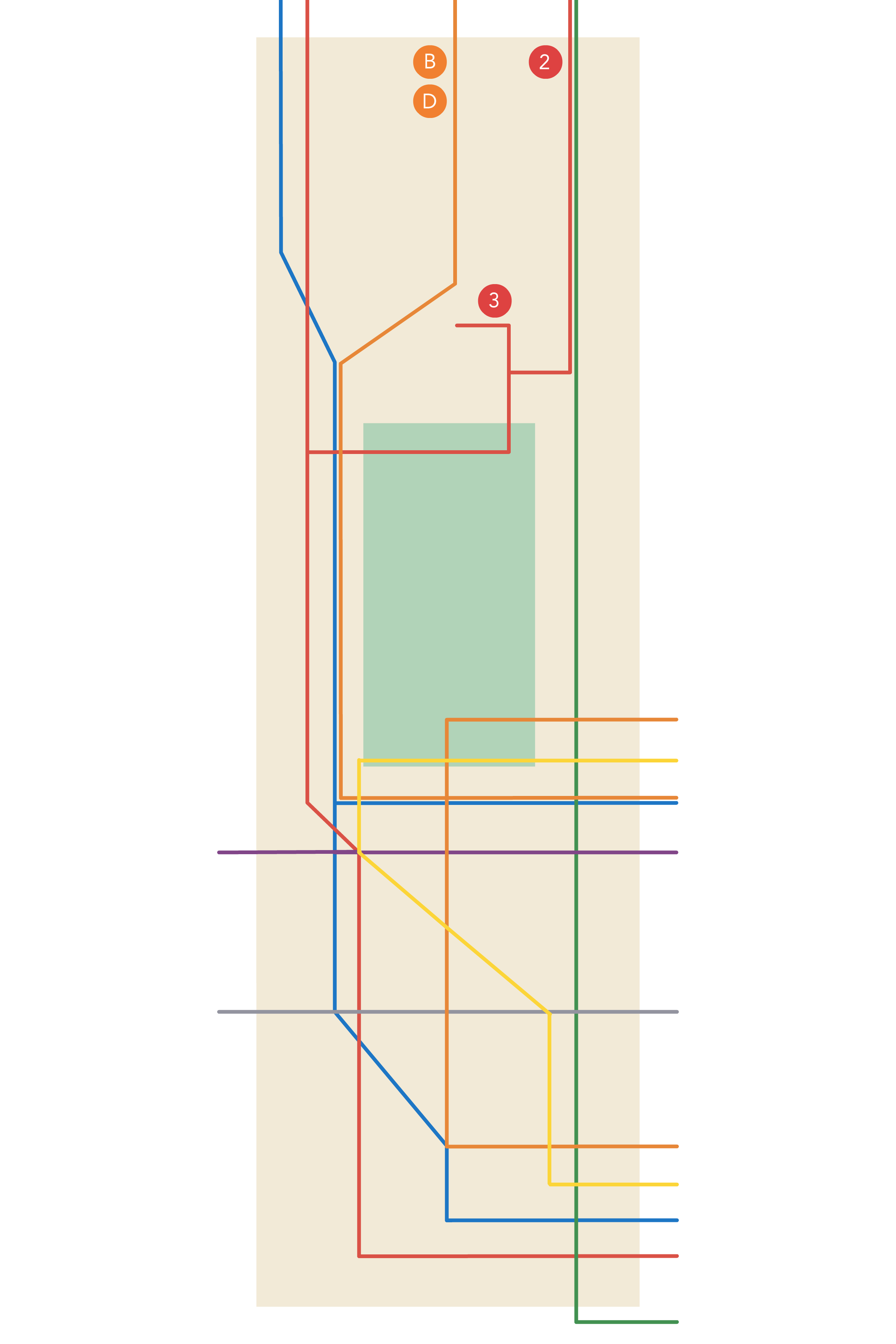
7. The red and blue lines actually do |
|
|---|---|
|
8. A few trains diverge from their lines to cover |
|
9. The J, Z, and S trains exist. |
|
Beyond that, it’s just a couple minor changes to get to a pretty good approximation of the Manhattan subway network.